Muckle Shore or Broadhaven Bay |
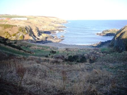 Here lies a pebble
beach and an oasis amidst the wildness of the surrounding coast, and on
a summer’s day an ideal location for a picnic and some swimming. Back in
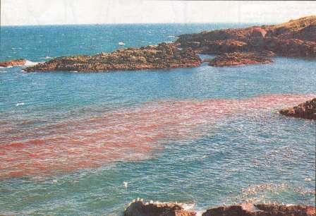
the 1980’s this place wasn’t quite so welcoming because the waste and
offal from the meat factory in Portlethen used to spill out from an
outfall near Findon Burn at the north of this bay – to say that the sea
was often blood red in this vicinity was no exaggeration.
Here lies a pebble
beach and an oasis amidst the wildness of the surrounding coast, and on
a summer’s day an ideal location for a picnic and some swimming. Back in
the 1980’s this place wasn’t quite so welcoming because the waste and
offal from the meat factory in Portlethen used to spill out from an
outfall near Findon Burn at the north of this bay – to say that the sea
was often blood red in this vicinity was no exaggeration.
Muckle Shore is under private ownership and was re-landscaped in the 1990’s so that a road leads down from the top of the shore directly onto the beach. After many years of no additional work being carried out the shore has reclaimed some of its wildness and is being rediscovered by nature and, in my opinion, is looking good.
In days of yore a
salmon coble worked from this shore and
a slipway ran from the grassy banks down towards the low water mark on
the north side of the beach however there is virtually nothing left now
to indicate that this was once the site of a fishing
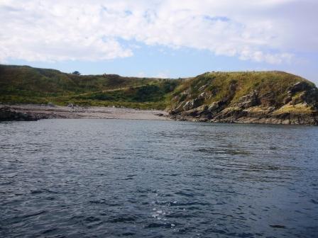 station.
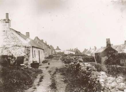
Additionally a small house or bothy could be found at the bottom of the
grassy slopes at the north end of the beach and there were three
buildings centrally placed that were used to store the nets and other
equipment associated with salmon fishing. Nothing of these buildings
remain today although all of them were still in place in the 1960’s and
it wasn’t until a decade later that natural neglect and vandalism caused
them to fall into disrepair and ultimate destruction. The only indicator
that fishing activity took place in this shore is one remaining wall at
the head of the shore, this wall was part of a winch house.
station.
Additionally a small house or bothy could be found at the bottom of the
grassy slopes at the north end of the beach and there were three
buildings centrally placed that were used to store the nets and other
equipment associated with salmon fishing. Nothing of these buildings
remain today although all of them were still in place in the 1960’s and
it wasn’t until a decade later that natural neglect and vandalism caused
them to fall into disrepair and ultimate destruction. The only indicator
that fishing activity took place in this shore is one remaining wall at
the head of the shore, this wall was part of a winch house.
.jpg)
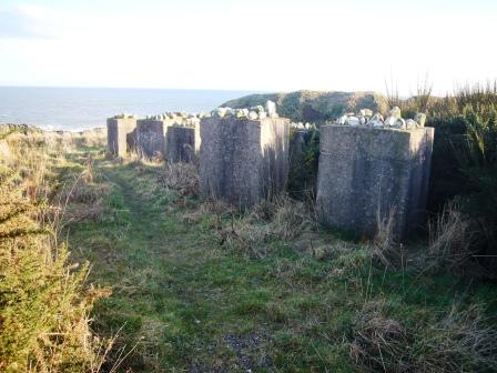 Additionally it’s worth noting the group of square
anti-tank blocks at the top of the north end of the bay, these are made
out of concrete and have stones set on top for camouflage. Their
presence here is a sure sign that Muckle Shore was identified as a
potential landing area for enemy machinery during
World War II.
Additionally it’s worth noting the group of square
anti-tank blocks at the top of the north end of the bay, these are made
out of concrete and have stones set on top for camouflage. Their
presence here is a sure sign that Muckle Shore was identified as a
potential landing area for enemy machinery during
World War II.
 I believe that this is still a privately owned beach but
having talked to the present owner in the past he seemed happy for the
locals to share and visit this sheltered piece of coast. There has been
talk of a private house being built there and/or the area being used as
a private shooting range however I believe that most of that was down to
rumour and gossip and it doesn’t look likely that anything is going to
change in this place any time soon.
I believe that this is still a privately owned beach but
having talked to the present owner in the past he seemed happy for the
locals to share and visit this sheltered piece of coast. There has been
talk of a private house being built there and/or the area being used as
a private shooting range however I believe that most of that was down to
rumour and gossip and it doesn’t look likely that anything is going to
change in this place any time soon.

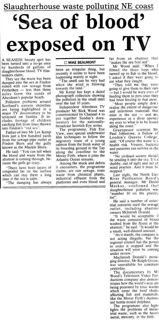 Article
on Pollution at Muckle Shore from 1991.
Article
on Pollution at Muckle Shore from 1991.
Some photographs of the pollution pouring into Broadhaven Bay/Muckle Shore 1991.