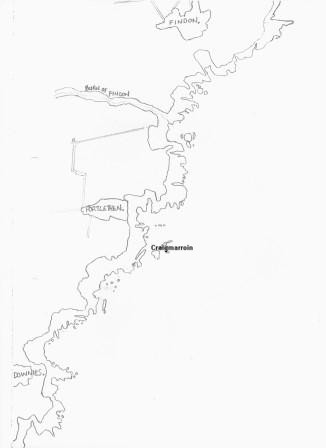
Craigmarroin |
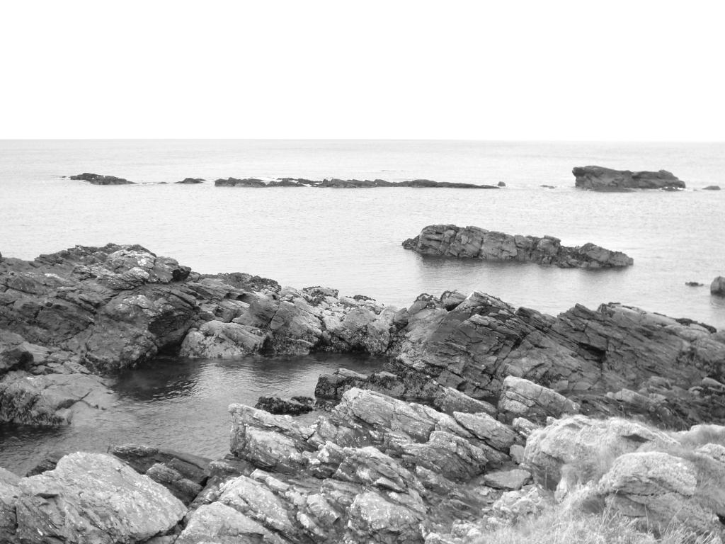
 This is one of the best known landmarks for miles around
and Craigmarroin is mentioned on most good maps. Here there is an
outcrop of island rocks that runs generally from north to south and
offers a bit of protection to the bay on the inner side however on a
wild day the seas will batter over these rocks as if they weren’t
there.
This is one of the best known landmarks for miles around
and Craigmarroin is mentioned on most good maps. Here there is an
outcrop of island rocks that runs generally from north to south and
offers a bit of protection to the bay on the inner side however on a
wild day the seas will batter over these rocks as if they weren’t
there.
These rocks have been the cause of many a shipwreck over the years and is the resting place of countless vessels although with the improvement in navigation over time nothing has run aground here for many a year – that certainly wasn’t the case in the 1700’s, 1800’s and the early part of the 1900’s when many boats, large and small, got caught out by the topography of land and sea in this area.
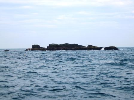
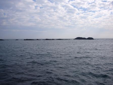
 The largest rock lying at the southern end of
Craigmarroin used to be known as the Outer Nook. Fifty yards beyond and
to the east of the Craigmarroin line there lies a single rock which used
to be known as Seals Craig. This rock is a “bus” and is probably the
cause of most of the shipwrecks that occurred here in the past.
The largest rock lying at the southern end of
Craigmarroin used to be known as the Outer Nook. Fifty yards beyond and
to the east of the Craigmarroin line there lies a single rock which used
to be known as Seals Craig. This rock is a “bus” and is probably the
cause of most of the shipwrecks that occurred here in the past.
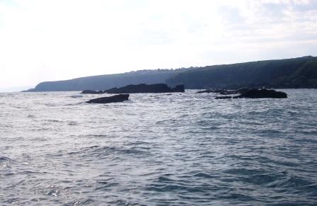
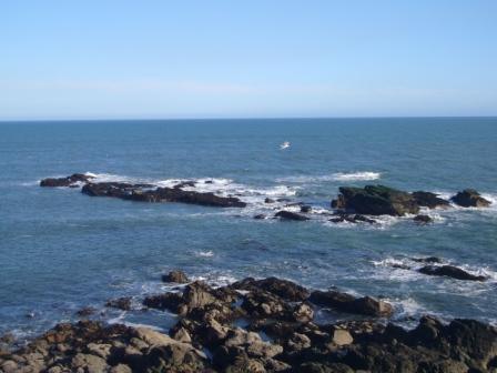
 Let me explain what a bus is before anyone starts having
visions of red London double deckers dotted around the coast! A bus is a
term used by the local sea going fraternity to describe a rock that is
positioned a few feet underwater that waves break over. They are a
treacherous obstacle to anyone in a boat who may not be aware of
anything abnormal until they are practically on top of them and by then
the danger is difficult, or next to impossible to avoid. The bus at the
back of Craigmarroin is a perfect example of an extremely dangerous one,
even to us who are very familiar with it.
Let me explain what a bus is before anyone starts having
visions of red London double deckers dotted around the coast! A bus is a
term used by the local sea going fraternity to describe a rock that is
positioned a few feet underwater that waves break over. They are a
treacherous obstacle to anyone in a boat who may not be aware of
anything abnormal until they are practically on top of them and by then
the danger is difficult, or next to impossible to avoid. The bus at the
back of Craigmarroin is a perfect example of an extremely dangerous one,
even to us who are very familiar with it.
 Locally this is also the most popular fishing area if you
are out in a boat and the fishing ground is known as “the back of the
Ron”, a shortened play on the word Craigmarroin. Here you will regularly
catch cod, pollock, saithe and mackerel in season as the ground is hard
and rocky and fish like to feed here. Unfortunately the catches have
diminished over the years and the best fish tend to be discovered in
small patches rather than over the complete ground which stretches about
half a mile north to south and about the same distance outwards
immediately from that dangerous bus!
Locally this is also the most popular fishing area if you
are out in a boat and the fishing ground is known as “the back of the
Ron”, a shortened play on the word Craigmarroin. Here you will regularly
catch cod, pollock, saithe and mackerel in season as the ground is hard
and rocky and fish like to feed here. Unfortunately the catches have
diminished over the years and the best fish tend to be discovered in
small patches rather than over the complete ground which stretches about
half a mile north to south and about the same distance outwards
immediately from that dangerous bus!
Typically nowadays most of fish are caught from the most dangerous area directly to the south of the bus and practically on top of it. It can be a challenge to fish here at all - not only have you to dodge buses and be aware of the sea conditions, you also have to avoid the abundance of creels that get dumped haphazardly all over the fishing ground.
 Note to any creelers out there – when placing creels at
the Back of the Ron please use the following as a guide. For Bashers –
run them north to south so that if we are fishing we can drift with the
tide alongside them rather than over the top of them. For Singles – keep
them to the inside of the bus, anything outside the bus is going to
disappear with the tide, we aren’t going to see their floats and as a
result we are going to get fouled on an unseen creel. I wonder how many
people actually understand what I’m talking about here.
Note to any creelers out there – when placing creels at
the Back of the Ron please use the following as a guide. For Bashers –
run them north to south so that if we are fishing we can drift with the
tide alongside them rather than over the top of them. For Singles – keep
them to the inside of the bus, anything outside the bus is going to
disappear with the tide, we aren’t going to see their floats and as a
result we are going to get fouled on an unseen creel. I wonder how many
people actually understand what I’m talking about here.
Okay back to Craigmarroin. Avoid in bad weather and beware the bus!