|
After
Joseph Johnston and Sons relinquished their lease on their salmon
fishing franchises in the northern Kincardineshire coasts, the salmon
fishing bothy, storage shed, blondin shed, and associated lands came up
for sale in 1981. Very quickly my father John, and brother Ron, made an
offer to the seller which was immediately accepted.
|
|
|
|
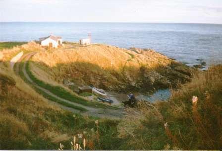
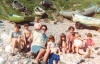
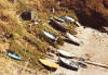
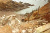
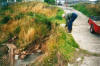
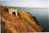
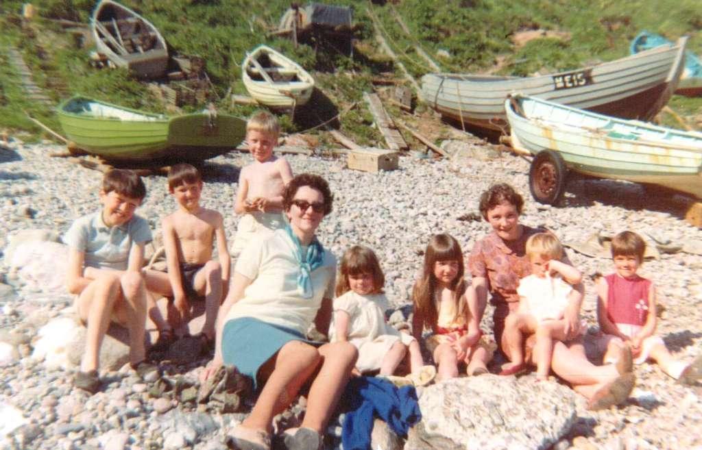
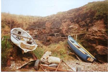
Portlethen Shore - 1969
A family photograph from 1969. One path (above green boat) leads from the shore to the Shore Head, another path (just beyond salmon coble) leads from the shore to the bothy. |
|
|
|
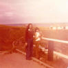
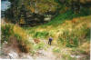
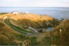
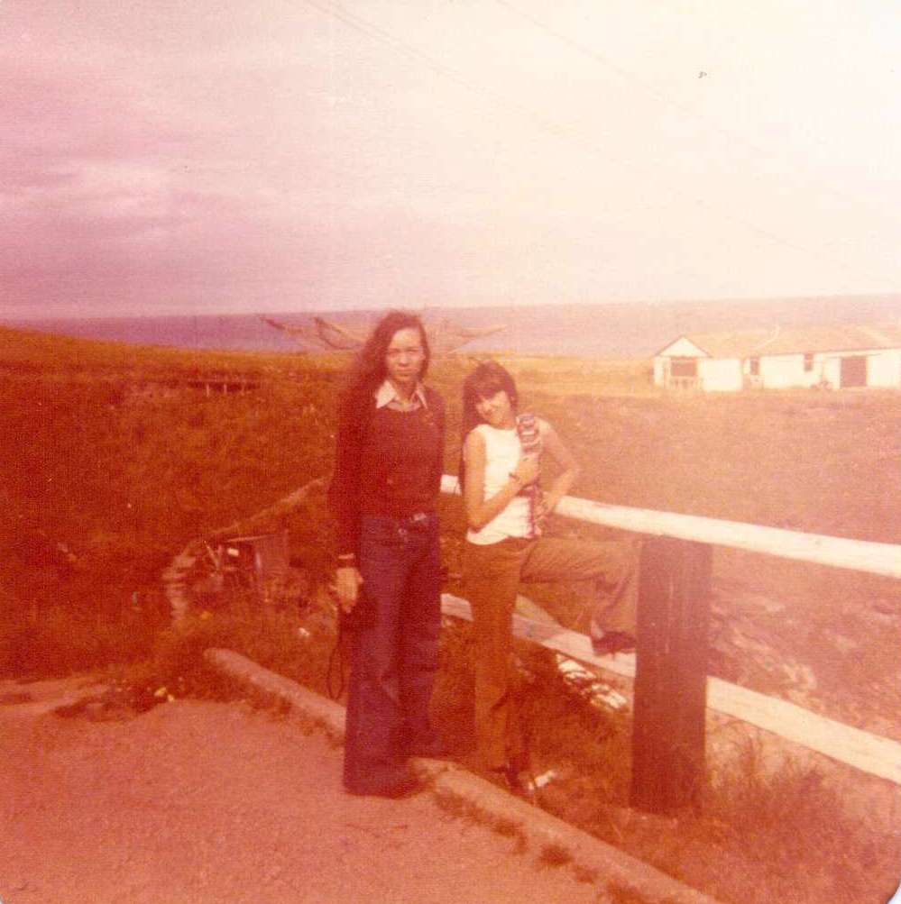
Shore Head - 1976
Laura Wyles & Patricia Kenn at the Shore Head. Note the old path leading down from the bothy to the shore. Note also the path leading from the Shore Head to the bothy - the clue is in the small wooden bridge pictured halfway up the photo. |
|
|
|
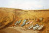
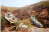
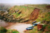
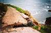
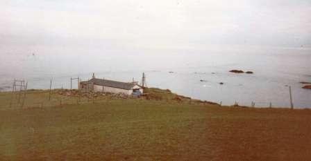
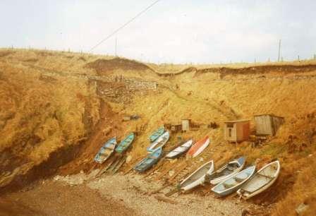
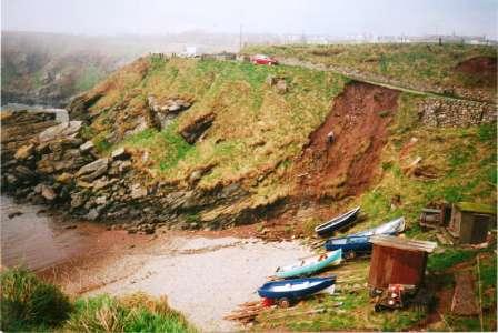
Portlethen Shore around 1980.
The path leading from the bothy to the shore is clearly visible in the centre left portion of this photo. What's not quite so obvious is the Shore Head to shore path at the bottom left corner just in front of the boats. |
|
|
John
wanted to continue utilising the bothy shed and lands, with an eye to
using them as a base for his new building venture, as well as the
likelihood of continuing with his inshore fishing projects on a part
time or hobbyist basis. Ron’s
interest was more practical – he wanted an independent place to stay and
moved into the bothy in 1981, making it his official place of residence.
In those early years there was no permanent source of electricity or hot
water and it would be a number of years before these basic necessities
became available. At the same time some major internal and external work
was made on the bothy itself to make it watertight and fit for
habitation. The first couple of winters may have been uncomfortable but
eventually the bothy evolved from a temporary working base into
permanent living quarters and Ron continues to live there today.
|
|
|
|
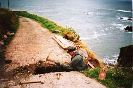
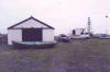
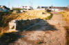
Portlethen Bothy, 1982.
The only proper access to the bothy was by single track paths - one around the shore head and one leading from the shore itself. |
|

|
|
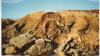
Portlethen Bothy, 1982
Viewed from the Morage park - source of many flooding problems that was to affect the new bothy road over the years. |
|
.jpg)
|
|
Building the new road to the Bothy, 1982.
The first tentative steps are taken |
|
.jpg)
|
|
Building the new road to the Bothy, 1982.
Anne Kenn lends a hand. |
|
.jpg)
|
|
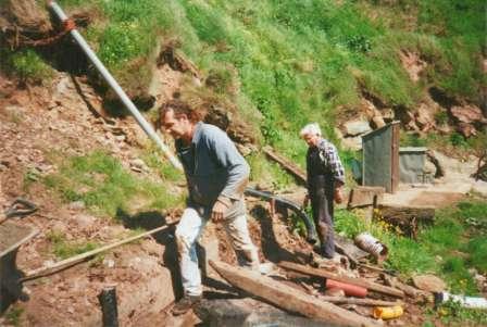
Building the new road to the Bothy, 1982.
John Kenn and George Craig plan on removing the old coble winch. |
|
|
The new
owners wasted no time in planning and developing the area around
Portlethen Shore and its immediate surroundings; primarily they wanted
to build a permanent road from the shore head (at the existing turning
point) that would allow vehicular access around to the bothy at the east
of the shore. There already existed a single path that allowed access by
foot but the plan was to expand the width of that path, which would
entail cutting further into the existing banks and flattening out any
dips and troughs so that a uniform track would follow the sweep at the
top of the shore from the turning point until it reached the bothy. It
was a big task for two individuals with no experience of civil
engineering to take on but take it on they did.
|
|

|
|
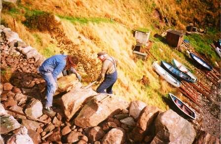
Extending the car park
A decision was made to extend the passing place halfway up the shore road into a parking place for two or three cars. |
|
|
|
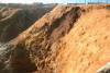
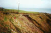
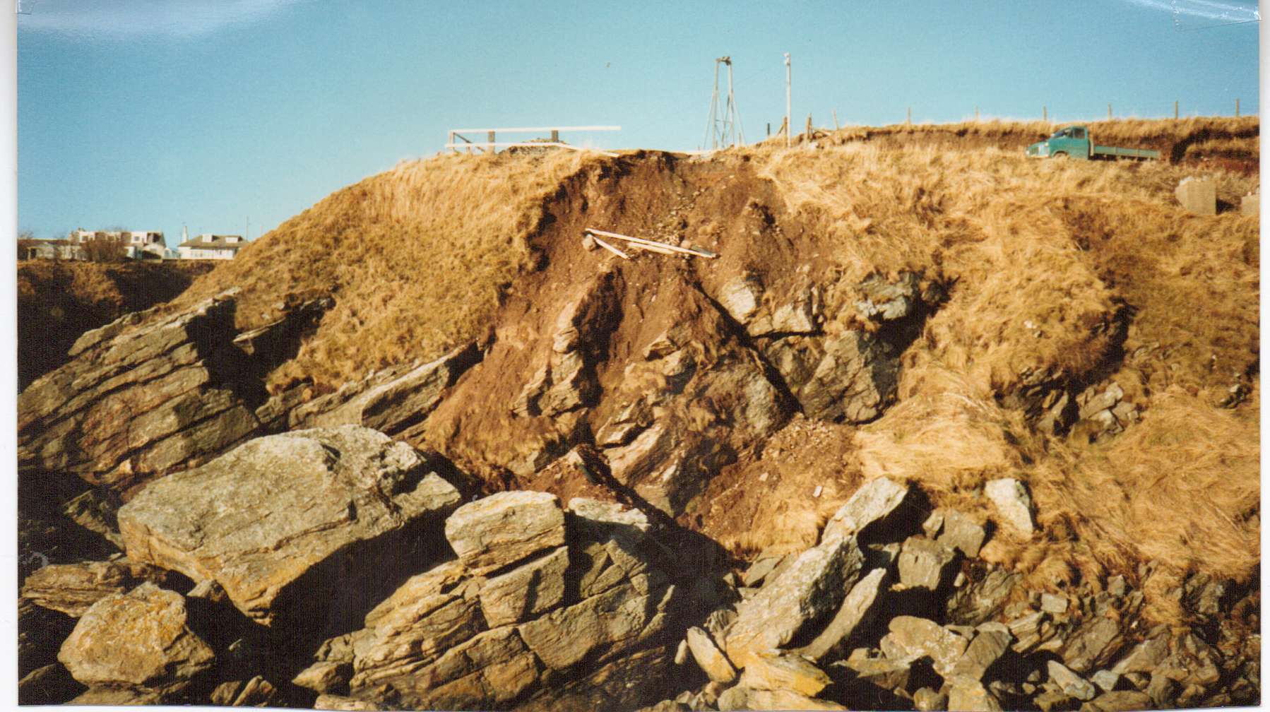
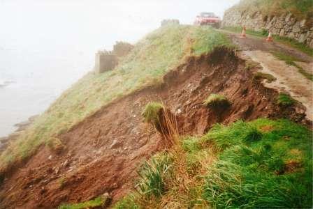
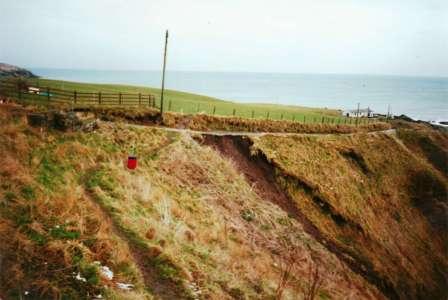
Landslide No. 1.
The first of many landslides that was photographically catalogued by Anne Kenn. |
|
|
|
Landslide No. 2.
|
|

|
|
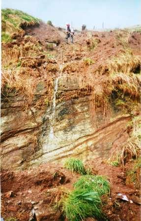
Landslide No. 3.
|
|
|
|
Landslide No. 3.
John goes to work (again) |
|
|
Before
I continue I should point out that prior to 1982 there was vehicular
access from the village to the shore head and at the shore head was a
turning area and perhaps parking space for two or three vehicles. From
the shore head there were two further paths; the upper path was the
aforementioned one that led to the bothy, whereas the lower path,
another single track path, led directly down to the shore itself, within
ten yards there were four anti-tank blocks which the path passed between
before twisting around to a series of steep stone steps that led
directly on to the beach. There was a third path, this path was built
for the convenience of the salmon fishers and began near the bothy, also
leading steeply and directly on to the beach, the route of this path lay
immediately behind where the boats at the eastern half of the beach
currently lie today.
None of
these single paths exist today in their original form and they have been
superseded by one road that can allow vehicular access from the shore
head to the bothy. Halfway along this road there is a new path with a
less steep gradient ending in a series of large boulder steps before the
pebble shore is reached. However before this current road and path
developed there was a lot of hard work and toil involved which I will
endeavour to describe in the following paragraphs.
|
|
|
|
Landslide No. 4.
|
|

|
|
Landslide No. 5.
|
|
|
|
Landslide No. 6.
|
|
|
|
Landslide No. 7.
|
|
|
|
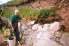
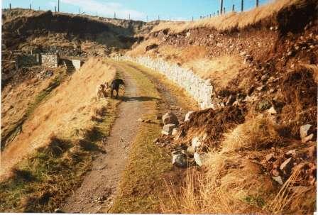
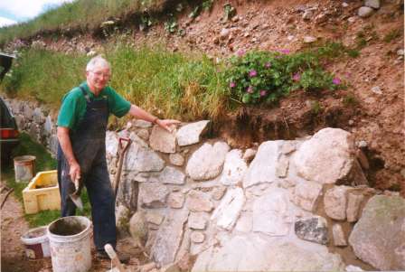
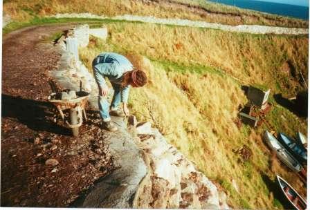
Wall Maintenance, 1999.
In between repairing landslides John managed to find time to do some general maintenance and enhancement work on and around the bothy and shore roads. He had by now "retired". |
|
|
Work
started on the construction of the new bothy road in 1982 and diggers
were brought in to excavate the existing banks and work precariously
from a position nearly 100 feet above sea level. It wasn’t just a case
of digging out swathes of earth from an existing bank and making a flat
track as the logistics of the area made it difficult to manoeuvre; Where
to put the excavated earth? How to ensure that the boats and winches on
the shore were protected from earth slipping down the slope? How would
they know that the working area was firm and safe for a digger to work
on? How to prop up and secure the road from landslides as it developed?
Was there going to be unseen problems in respect to underground water
and drainage? Would there be any damage to the neighbouring field or
fencing?
Whatever pitfalls were discovered, by the end of 1982 there was a track
running between the shore head and the bothy that was wide enough to
allow a car to drive from one side to the other. Of course, during the
construction of this road the two existing paths that led from the bothy
and the shore head into the shore had now been covered in earth and the
old anti-tank blocks that had been a common sight for many years had
been almost completely buried. It was essential that, as the road was
being constructed, a temporary path had to be built that would allow
boat owners access to their craft and this was duly done and made
permanent and safe over the following years.
|
|
|
|
Landslide No. 8.
Landslide number 8 was a large and problematic landslide and took many months of hard work to put right. |
|

|
|
Landslide No. 8.
|
|

|
|
Landslide No. 8.
Ron and John hard at work repairing the damage caused by Landslide Number 8. |
|

|
|
Landslide No. 8.
John in precarious position whilst repairing Landslide number 8. |
|
%20working%20on%20Landslide%20No%208%20-%20July%202000%20.jpg)
|
|
Landslide No. 8.
John uses scaffolding to assist in the repair work. |
|
|
The
project was deemed a success but as with any construction project scars
were left, the area around the road and the braes would look bare and
unattractive for a number of years until nature took its natural course
and plant life returned. My mother, Anne, along with my father and
brother helped nature on its way by planting flowers and saplings as
well as repositioning the clumps of grass, wild flowers and even the
best looking weeds. The reason for this was two-fold; to make the area
look more attractive and to bind and firm up the new earth foundations.
I’m
sure that for a few years some villagers probably looked on this new
construction as a blot on the landscape and a step backwards and it
wasn’t until plant life returned to the bare areas that most people
would have been pleased by the look as well as by the outcome – safer
and wider paths to the shore and the bothy beyond.
|
|

|
|
Landslide No. 8.
Ron and John continue to repair Landslide No. 8. |
|

|
|
Landslide No. 8.
Ron adds the final touches. |
|
|
|
Landslide No. 9.
|
|
|
|
Landslide No. 9.
John at work on Landslide No. 9. |
|
|
|
Landslide No. 9.
John at work on Landslide No. 9. "I think I'll build a bridge"
|
|
|
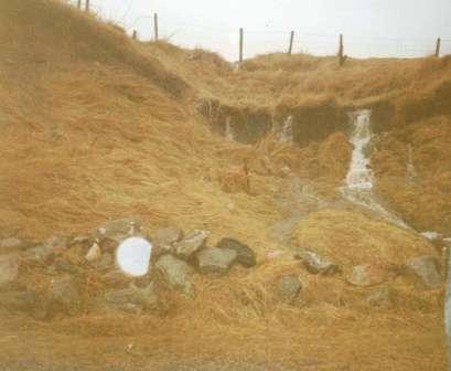
The new
road construction, however, highlighted, or possibly even exacerbated
hidden problems and none more so than the run of water that spilled down
the existing shore road and neighbouring field, particularly following a
heavy fall of rain. As a result there were many landslides that resulted
in part of the new bothy road being washed away and slipping down the
bank into the shore or alternatively the banks at the side of the road
collapsing and causing a blockage. On occasions of severe rain it was
possible to experience both at the same time.
Anne
kept photographic records of some of these landslides which occurred at
various points along the new bothy road and, on a couple of occasions,
along the existing old shore road – once near the village itself and on
another occasion halfway down the shore road near a new parking area
constructed area. The landslides in the photographs occurred between
1983 and 2001. I believe that there may have been a lot more than the
nine different landslides that were photographically recorded by Anne –
maybe these weren’t quite so serious?
|
|
|
|
Building the Bridge.
John in the gully at Camibeg whilst working on new bridge
|
|
%20%20-%20September%202001.jpg)
|
|
Building the new Bridge.
Work starts on the new bridge - John Kenn with George Craig, September 2001. |
|
|
|
Building the new Bridge.
Sorting out the drainage prior to the building of the bridge. |
|

|
|
Building the Bridge.
The bridge takes shape |
|
|
|
Building the Bridge.
Removing the bridge profile |
|
|
Rather
than give a blow by blow account of all the landslides that occurred
I’ll let the photographs tell their own story. Each and every landslide
that has occurred has been repaired by John and Ron and included
additional remedial work.
The
last landslide (and let’s hope it is the last) occurred in 2001 and as a
cure for this landslide, which occurred in an awkward place near to the
village, John built a bridge! He was ably assisted in this project by
another old age pensioner and neighbour, George Craig, who lives 50
yards from where this final landscape occurred.
|
|
|
|
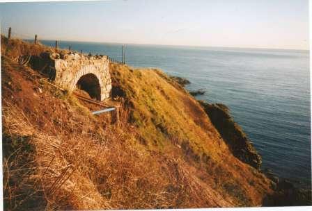
Bridge Completed!
A view from the village, November 2001. |
|
|
|
Bridge Completed!
A view from the Shore Road, November 2001. |
|
|
|
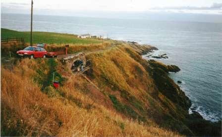
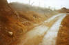
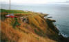
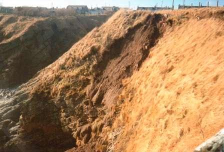
An overview of the bothy road
Photographed in 1999. |
|

|
|
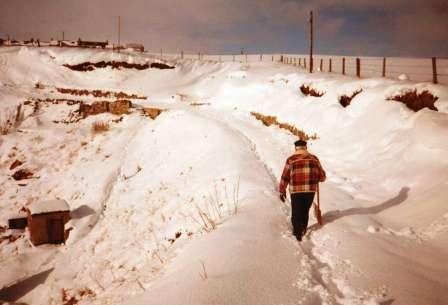
The good work continues in winter....
|
|

|
|
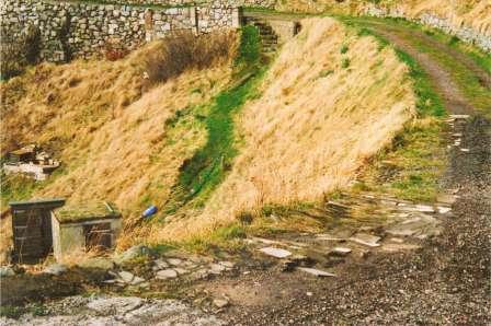
....and summer.
|
|
|
I’ll
quote directly from my mother’s notes to close off this particular
chapter of my family history.
“All
the landslides at the shore have been caused by water coming off the
fields, apart from the first at the ‘turning area’ and the fourth,
halfway down the shore road, which were caused by heavy downpours
running down the road. All have been repaired by Johnny and Ronald.
Sometimes Johnny had to go into the fields and repair field drains
himself, as he knows the locations of all the springs and drains. After
Graham Shand took over at the Mains of Portlethen, Johnny got him, in
2004, to dump a load of stones above the dip in the field – where the
notorious ‘corner’ is. Let’s hope that, and all the work that Johnny has
put in, cures it for all time”. |


.jpg)
.jpg)
.jpg)


%20working%20on%20Landslide%20No%208%20-%20July%202000%20.jpg)


%20%20-%20September%202001.jpg)