Moss Facts according to Wikipedia |
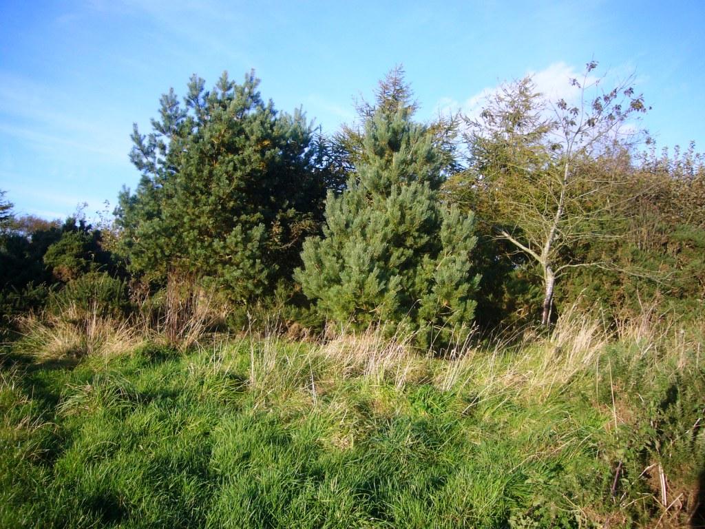
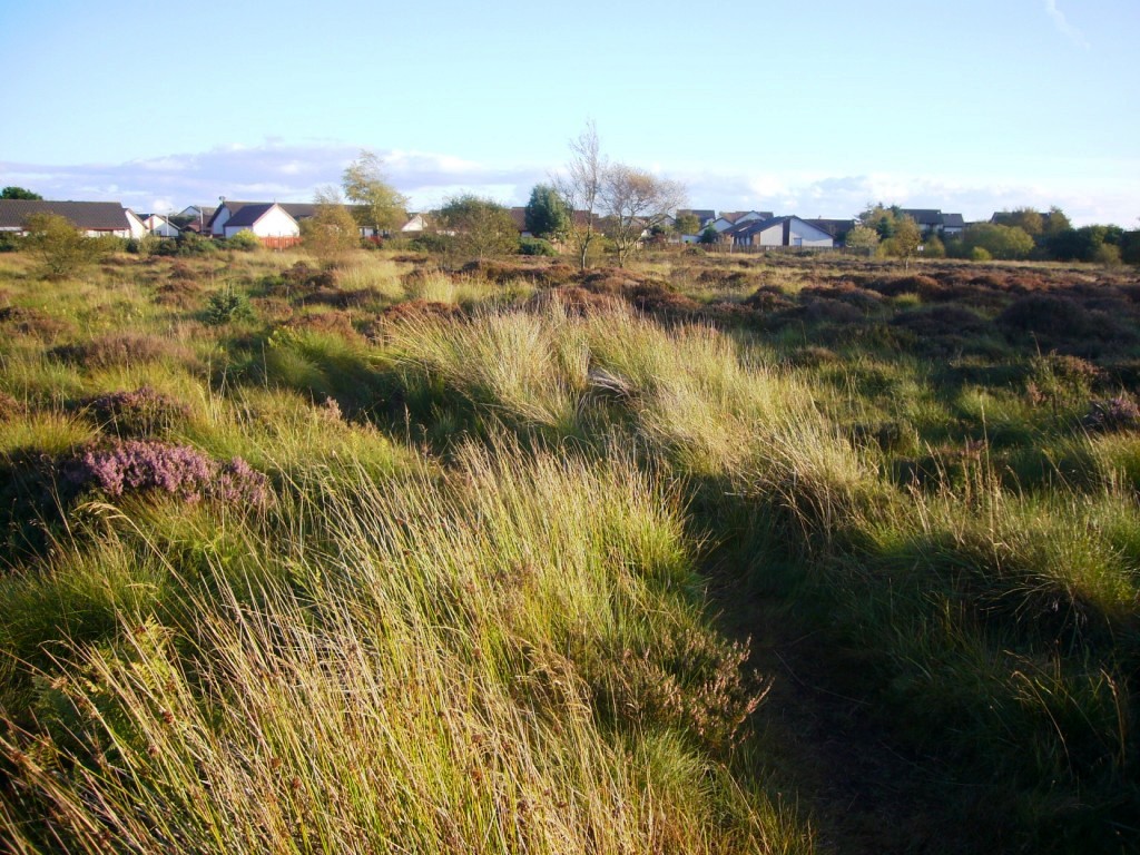
The 'Portlethen Moss' is an acidic bog nature reserve in the coastal Grampian region in Aberdeenshire, Scotland. Like other mosses, this wetland area supports a variety of plant and animal species, even though it has been subject to certain development and agricultural degradation pressures. For example, the Great Crested Newt was found here prior to the expansion of the town of Portlethen. Many acid loving vegetative species are found in Portlethen Moss, and the habitat is monitored by the Scottish Wildlife Trust.
 The Portlethen Moss is the location of considerable
prehistoric, Middle Ages and seventeenth century history, largely due to
a ridge near the bog which was the route of early travellers. By at
least the Middle Ages this route was more formally constructed with
raised stonework and called the Causey Mounth. Without this roadway,
travel through the Portlethen Moss and several nearby bogs would have
been impossible between Aberdeen and coastal points to the south.
The Portlethen Moss is the location of considerable
prehistoric, Middle Ages and seventeenth century history, largely due to
a ridge near the bog which was the route of early travellers. By at
least the Middle Ages this route was more formally constructed with
raised stonework and called the Causey Mounth. Without this roadway,
travel through the Portlethen Moss and several nearby bogs would have
been impossible between Aberdeen and coastal points to the south.
History
 Prehistoric man inhabited the Portlethen Moss area as
evidenced by well preserved Iron Age stone circles and other excavated
artefacts nearby. Obviously only the outcrops and ridge areas would have
been habitable, but the desirability of primitive habitation would have
been enhanced by proximity to the sea and natural defensive protection
of the moss to impede intruders. From Tacitus accounts of the Roman
general Agricola, it is known that the Romans were daunted by Portlethen
Moss, Netherley Red Moss, Cookney Moss and other local bogs that
hindered travel. This is also evidenced by the northernmost Roman Camp
of Raedykes having been established immediately south of this cluster of
mosses, the Romans not being able to progress further north along the
coast before construction of the Causey Mounth.
Prehistoric man inhabited the Portlethen Moss area as
evidenced by well preserved Iron Age stone circles and other excavated
artefacts nearby. Obviously only the outcrops and ridge areas would have
been habitable, but the desirability of primitive habitation would have
been enhanced by proximity to the sea and natural defensive protection
of the moss to impede intruders. From Tacitus accounts of the Roman
general Agricola, it is known that the Romans were daunted by Portlethen
Moss, Netherley Red Moss, Cookney Moss and other local bogs that
hindered travel. This is also evidenced by the northernmost Roman Camp
of Raedykes having been established immediately south of this cluster of
mosses, the Romans not being able to progress further north along the
coast before construction of the Causey Mounth.
This ancient Causey Mounth passage specifically connected the Bridge of Dee to the town of Stonehaven This route was used to access the historic meeting of the Covenanters at Muchalls Castle in the year 1638 AD as they opposed the Bishops of Aberdeen. The route was also that taken by the William Keith, 7th Earl Marischal and James Graham, 1st Marquess of Montrose when they led a Covenanter army of 9000 men in the biggest battle of the Bishops' Wars in 1639.
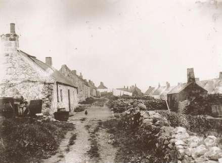
 Further to the east of Portlethen Moss lie three original
coastal fishing villages: Findon, Portlethen Village and Downies. In the
period 1960 to 2005 the town of Portlethen has developed as a bedroom
community to Aberdeen and a location of retail big box store
construction.
Further to the east of Portlethen Moss lie three original
coastal fishing villages: Findon, Portlethen Village and Downies. In the
period 1960 to 2005 the town of Portlethen has developed as a bedroom
community to Aberdeen and a location of retail big box store
construction.
Conservation status
The Portlethen Moss is a recognized nature preserve by
the Scottish Wildlife Trust (with designation PLM076) and the
Aberdeenshire Council. While peat cutting was conducted in prehistoric
and Middle Ages times, there has been no harvesting of peat in the
modern era. There is some ongoing loss of moss habitat from cattle
grazing, but the most significant threat is from ongoing land
development pressure; in fact, half of the Portlethen Moss has been lost
to urban (low density) land development by
 the town of Portlethen during
the period 1985 to 2005. Trampling is considered an insignificant threat
due to the small animal or human presence in the existing nature reserve
area; furthermore, cattle grazing while ongoing, is deemed a much lesser
current threat than population expansion pressure. Enrichment (addition
of grazing animal manure) is not a major issue due to the low density of
animals. As a net result damage to the primordial moss is considered
extensive and widespread by the Scottish Wildlife Trust. The raised bog
habitat of the Portlethen Moss is also protected by the UK Biodiversity
Action Plan.
the town of Portlethen during
the period 1985 to 2005. Trampling is considered an insignificant threat
due to the small animal or human presence in the existing nature reserve
area; furthermore, cattle grazing while ongoing, is deemed a much lesser
current threat than population expansion pressure. Enrichment (addition
of grazing animal manure) is not a major issue due to the low density of
animals. As a net result damage to the primordial moss is considered
extensive and widespread by the Scottish Wildlife Trust. The raised bog
habitat of the Portlethen Moss is also protected by the UK Biodiversity
Action Plan.
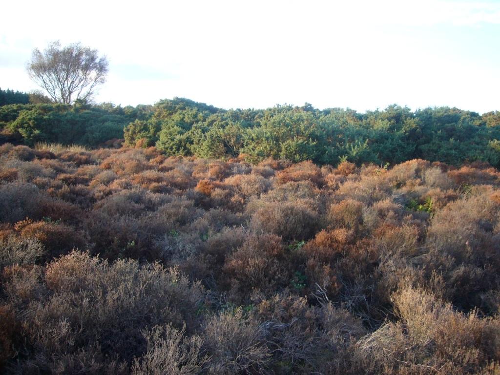
Topography and meteorology
Portlethen Moss is considered a raised bog, because its
general situation is on higher ground, at the edge of the Mounth, a
coastal mountain spur of the Grampian Mountains overlooking the North
Sea. There are rock outcrops and strewn boulders relict from the glacial
age at this site. Elevations within the Portlethen Moss range from
approximately 35 to 60 meters above sea level. Formation of this moss
has
 occurred due to extensive sets of depressions in the underlying rock
formations of Old Red Sandstone. The entire water composition of the bog
thus has been provided by precipitation with no source of surface
runoff, since the topography reduces to lower elevations in every
direction. Due to the high winds, moderate precipitation and cool
temperatures that generally prevail, conditions are favourable for
formation of an acid bog, since water stagnates, but eventually
evaporates with ensuing acidity enhancement of decaying organic matter.
There was virtually no drainage outlet in prehistoric times and little
drainage even in modern times.
occurred due to extensive sets of depressions in the underlying rock
formations of Old Red Sandstone. The entire water composition of the bog
thus has been provided by precipitation with no source of surface
runoff, since the topography reduces to lower elevations in every
direction. Due to the high winds, moderate precipitation and cool
temperatures that generally prevail, conditions are favourable for
formation of an acid bog, since water stagnates, but eventually
evaporates with ensuing acidity enhancement of decaying organic matter.
There was virtually no drainage outlet in prehistoric times and little
drainage even in modern times.
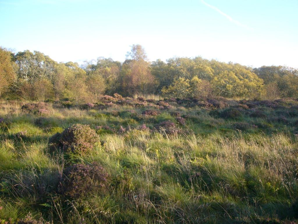
Evolution of Portlethen Moss
 Many coastal mosses were initiated by the process of
glaciation, which sheared rock formations to a generally level terrain,
while also gouging moderate sized craters that would pond. This
description fits the fundamental situation of Portlethen Moss, whose
spagnum would have flourished over millennia of evaporation, further
intensifying the soil acidity, fuelled by organic matter decaying, with
little drainage outlet. A layer of sphagnum moss would have developed at
the benthic level of the bog, and additional spagnum layers floated in
mats atop the bog.
Many coastal mosses were initiated by the process of
glaciation, which sheared rock formations to a generally level terrain,
while also gouging moderate sized craters that would pond. This
description fits the fundamental situation of Portlethen Moss, whose
spagnum would have flourished over millennia of evaporation, further
intensifying the soil acidity, fuelled by organic matter decaying, with
little drainage outlet. A layer of sphagnum moss would have developed at
the benthic level of the bog, and additional spagnum layers floated in
mats atop the bog.
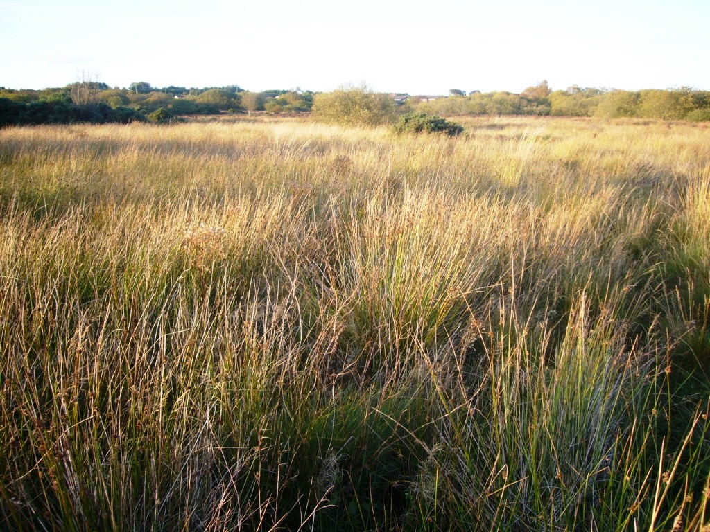
At an intermediate level of evolution, thick peat layers
formed from decay and carbonization of the rotting spagnum. Generations
of carex and juncus flourished, leading to further decay of these
materials and eventual heightening of the organic mass. Finally,
secondary vegetation took root in the spongy spagnum mats adding greater
biomass to the bog. In some cases the heavy saturated organic layers
 could actually rupture, spilling large volumes of mud and organic debris
to surrounding fields, thus enabling a bed for further spatial expansion
of the entire bog. Ultimately the colour of the moss waters became blood
red in colour, from the successive organic decay and stagnation. Only in
times associated with cattle grazing and significant human presence
(probably the late Iron Age), would this process reverse and the bog
reduce in size.
could actually rupture, spilling large volumes of mud and organic debris
to surrounding fields, thus enabling a bed for further spatial expansion
of the entire bog. Ultimately the colour of the moss waters became blood
red in colour, from the successive organic decay and stagnation. Only in
times associated with cattle grazing and significant human presence
(probably the late Iron Age), would this process reverse and the bog
reduce in size.
Note: All photographs on this page taken within Portlethen Moss in October 2009.